Tells Peak
Desolation Wilderness
Crystal Range
Elevation 8,876
While we were spending the weekend lakeside on the beautiful Shadow Lake, we decided to make a run for the top of Tells Peak.
We knew this would be an adventure since there was no real trail, but it looked like a fun way to spend the day. We were also considering bagging nearby McConnell Peak as it was only another mile as the crow flies.
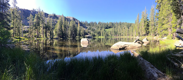
We left our camp at Shadow Lake right after breakfast.
Hard to leave this beautiful setting, but the peak was calling...
We walked to the south side of the lake and headed up towards the peak.
We can see our camp through the trees here.
A tiny pond full of tadpoles. Looks like a heart shape too!
We saw lots of small ponds/lakes as we climbed higher.
Definitely looking more and more like Desolation Wilderness as the trees are thinning and the rock colors have that distinctive desolation look.
And higher we climb. That peak is getting closer!
There were a few clearings which we really appreciated.
Lots of rock scrambling to come.
Hello rocks!! We will be spending some time here getting to the top.
This mountain is also full of false peaks,
so until you actually reach the top, top with the cache box, keep on going!
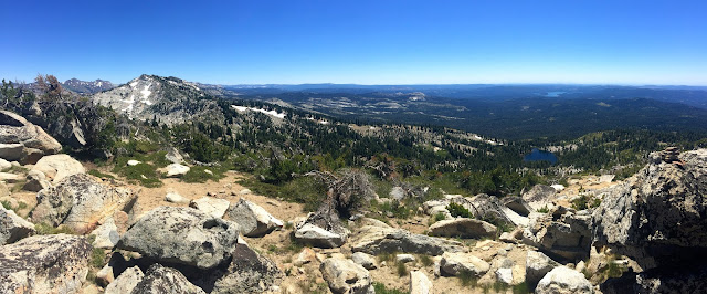
Wow, those views!
Boulders? Manzanita? Yes!! We just keep moving upwards.
No trail? Just go!!
We picked a gorgeous day to be out here as you could see for miles and miles.
The views from the top
We added a few rocks to the Cairn. This is the top of Tells Peak!
We stopped and relaxed for a few minutes for a snack before we head back down.
Not a bad view to enjoy a meal. Still some snow up there too.
We decided that making a double peak would not work for today. We did not plan on it taking quite this long and did not bring enough water to get that far and back down.
Just another reason to get gone up here again!
Looks innocent enough, right?
Until you realized you have to jump down off of these boulders and down into the manzanita that is up to your waist in some areas. Gators would have been a good idea...
As we were coming back down these huge fields of rocks,
looking back up was kind of crazy.
We just climbed down that? Yep!
Getting back down was almost as hard as getting up the mountain,
but what an amazing day.
Now to sit by the lake at camp and relax.
We are heading out tomorrow and going to go and find the B17C crash site.
Our tracks as recorded by Strava
Elevation map. Just over 4 miles total with almost 1,600 ft of climbing.
Always a great day to get to the peak of a mountain, even when it's hard work.
No, go get gone!


Comments
Post a Comment