
Henry's Peak - Elevation 9,327
Lookout Peak - Elevation 9,577
Peep Sight Peak - Elevation 9,716
Lookout Peak - Elevation 9,577
Peep Sight Peak - Elevation 9,716
Carson Iceberg Wilderness
Alpine County
Stanislaus National Forest
Stanislaus National Forest
Misadventures sometimes make for the best adventures...
We didn't know it, but this would become a very true statement soon...
In the meantime we will enjoy the excitement of getting gone.
It's Veteran's Day 2016.
First and Foremost...
Thank you to all of those who have served and continue to serve our Country.
Chris had the day off Friday in observance of the Holiday and I was off at 1:30. We were packed and on the road by 2:40. We have a 3 hour drive and very little light, thank you daylight savings time... NOT!
Take Highway 4 east from Highway 99 in Stockton into the mountains for 95 miles to Bear Valley. One mile after Bear Valley, the highway passes Lake Alpine and becomes a one-lane road. This marks the winter closure spot. Continue on another 10 miles of narrow, winding road. The road will climb over Pacific Grade Summit (8,050 ft) and descend into a valley. The Pacific Valley Campground is located about a mile after the summit, in the valley. The campground is usually open once most of the snow melts out. Turn right onto the campground road and drive about .75 miles to the Pacific Valley trailhead parking area. There are campsites, toilets, and wilderness info boards there.
Take Highway 4 east from Highway 99 in Stockton into the mountains for 95 miles to Bear Valley. One mile after Bear Valley, the highway passes Lake Alpine and becomes a one-lane road. This marks the winter closure spot. Continue on another 10 miles of narrow, winding road. The road will climb over Pacific Grade Summit (8,050 ft) and descend into a valley. The Pacific Valley Campground is located about a mile after the summit, in the valley. The campground is usually open once most of the snow melts out. Turn right onto the campground road and drive about .75 miles to the Pacific Valley trailhead parking area. There are campsites, toilets, and wilderness info boards there.

On our way to GO GET GONE!

This is where we are headed. Pacific Valley Campground South of Hwy 4 in Alpine County. We plan to explore Henry's Peak, Peep Sight Peak and Lookout Peak. This area is located in the Carson-Iceberg Wilderness and about 10 miles east of the town and ski area of Bear Valley.


We made it to the campground. No services this time of year. Pack Out what you Pack In.
Got it... We don't need no stinking services anyway. Having a porta potty and a campground is way more than we usually have backpacking, so this is more like GLAMPING!"

Coordinates to Silver Valley Campground. Our home for the next couple of nights.

First night was a quick reheat of dinner from home. Butternut squash and garbanzo bean stew with chicken and toast. Was just what we needed.

Oh, and a fire. We definitely needed that!!
It's getting cold quickly. I think it's going to be an early, early night. By 8pm, temps are already dipping into the high 30's. We are turning in for the night.

What a gorgeous morning.
Neither of us had an alarm set and before we knew it, it was 8:30 am!!
Wow, that was some amazing sleep!
Guess we were both tired and cold mountain air was just what we needed.

Home sweet home for the next couple of days.

And after being backcountry backpacking all summer, the porta potty is a welcomed sight.
No cat-holes on this trip!

Love this tree. It's in our camp.


Breakfast on day 2... Breakfast burritos! YUM!

Trailfie! About to head out! A little bit of a late start after sleeping in, enjoying tea/coffee and breakfast by the fire and enjoying the beautiful morning. Got on the trail at about 10:40am.

Trailhead marker - no day permits needed.

Trailhead coordinates

And off we go down the trail!

Lookout from the North side


Turn left here. Since the places we are headed have no trails, there is nothing on the signs about the peaks. We will be off trail soon.


Henry's Peak through the trees

Trails were hard to see in some areas, so we built cairns and marked a few places with trail tape.


Look ma no hands! Making my way over one of MANY water crossings. All were easy to get over.

Lots of boulder fields along the way. Pretty easy to climb over though.

Woohoo! the meadow we were looking for is a that-a-way!!

Carson Iceberg Wilderness Sign. It's not quite the Desolation Wilderness Sign that I also pose with, but for this GGG Adventure it'll have to do. Stanislaus has been good to us so far.

What? Broken route marker, compass and map in hand... Which way do we go??

Henry's Peak. That Rock was just too much for us to climb from this side. We are close, but not quite there. Will have to make another effort and come in from the other side.
Another day...

A small lake at the bottom of Henry's Peak


Lookout peak far left, peep sight peak far right.
We will see both of you tomorrow.

Chris taking in some beautiful views of the valley below.

Enjoying lunch and looking at what our day has in store for us tomorrow. Peep sight peak is just above my head on the ridge line.

Yummy LUNCH!!
Ciabatta bread with Prosciutto, Copa Salami, Artichoke Antipasto, Roasted red peppers, Fresh Basil, Mozzarella and Asiago Cheese.


Looks like we climbed a mountain... We did. It's name was Henry's Peak.

Yep, we got pretty close to the peak and almost visited Henry. He may have to wait for another trip when we can come to the back of his house and enter that way. The Front side had a rock wall a little too high for us to climb over. Next time...

Dinner! Tonight's menu selection was Mexican! Chicken Enchinachos! Shredded chicken and enchilada sauce with fresh salsa and avocado with Chimichurri rice.

More "Chris-genius" ideas. Insulated window covers. Boy, did we ever need them on this trip.

And Chris strikes again. He had everything elevated and stacked on containers so our air mattress fit perfectly up on top. It was super cozy!

Seriously? It's 27 degrees and time to get out of bed?
I purposely put my tempe sensor outside to see how low it was going to get. That may have been a mistake. If I hadn't done that, I wouldn't have known it was 27 degrees! Brrrr!!

Even the INSIDE of the windows are frozen... Good thing Chris started the car for me so I can get dressed in the heat! Thank you sweetie! 💙

Morning sun peaking through the trees with Lookout Peak behind it.
Come on out sun and bring us some heat!
It is forecast to be a gorgeous weather day today.
So far so good.

Pretty tree with frost on it. Everything started to sparkle once the sun came out. Very pretty.


Perfect breakfast before heading out for some peak bagging.


Baby it's cold outside...
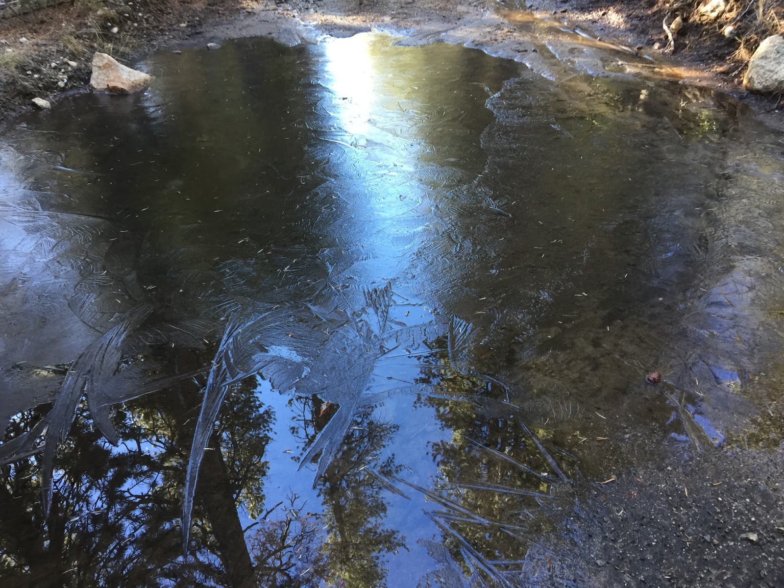
Cold enough to freeze the small ponds and that pine cone never had a chance to escape.
27 when we woke up this morning, but about 35 by the time we left camp.


Henry's Peak as we start to climb up lookout peak.


I would say that is pretty steep indeed. We've climbed steeper and this terrain was pretty easy to navigate. We were having a blast.

Just about 500 feet to the peak. Looks easy enough!


And then there's this to climb...
It's actually not too bad. Rocks stay in place pretty well.

You can see me on the hillside for some perspective on how high we have to go and how many rocks there are. TONS!

We were taking pics of each other and didn't even know it. Chris is climbing up to my right. Who will make it first?

We got there together!! Lookout Peak Marker!

Looking over to Henry's Peak and where we were yesterday.


There were just a few notes in the plastic container. One was from a couple who had been there over 40 years ago and happily married since. AWESOME SAUCE!
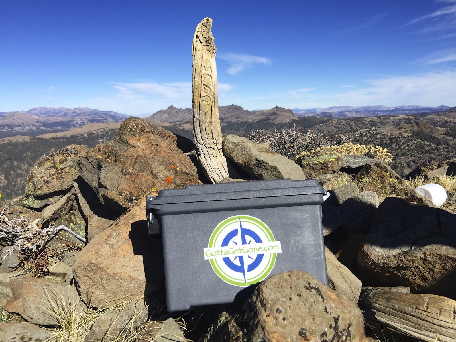
GottaGetGone's first Peak log and cache box. We were happy to find this peak needed one. There was a plastic protein powder canister here and it was time for an upgrade. Can't wait for it to get some use and hope it's here for years to come! The wood is carved 3/7/35 - wondering if it's been there that long of it that is a significant date for something else.
There were no notes about it, so it's anyones guess.

We had such an amazing time up here AND we had cell service.
So we did a Facebook Live video!

We are headed over there next. Peep Sight Peak here we come!!
2 miles as the crow flies. Looks like a pretty direct route too, but we will see what the bottom of the mountain holds in store for us since there are no trails.


On our way to Peep Sight and looking back on Lookout Peak.
What a beautiful peak. The views were absolutely amazing.

Rocks anyone? Lots and lots of this stuff...
This bush would just reach out and grab you and stab you. Chris had a not-so-nice name for it by the end of the day. Let's just call it "Richard"... and leave it at that.

Chris survived another brush with "Richard" and is making his way up towards the peak.

This stuff is no joke. It just slides and slides when you step on it. The grade is quite steep so it's slow going just trying not to slide down the mountain...


Slowly heading up towards the highest peak. Coordinates say it's the one all the way to our left.

The prominence farthest left was was the Garmin coordinates was calling the peak. This loose rock goes on and on. There was no way we were getting all the way up there without serious injury. So, this is what we are going to call "the peak". It took me a while to finally let it go. I don't like to leave things unfinished. But it's good to have two heads making decisions. Sometimes one of us has to be the voice of reason and today it was Chris calling it a bad idea to continue. I didn't want to stop, but later totally agree that he made the right call on that one. It was crazy steep and very loose rock.

With a mix of loose rocks and snow, making our way down from the peak and over to where the Peep Sight area is wasn't a walk in the park... or the mountains. Slow going at best.


These Giant spires look like they are from another planet. Very rough and dimply. I kept saying they look like they have warts. 😜

Making my way over to Peep Sight from the actual highest peaks on the mountains. All three of them are essentially "unpeakable". I would skip that attempt next time and save the 40 minutes it takes to get over here to spend more time looking at Peep Sight Peak.

Chris getting up to the top of Peep Sight Peak.

And while on top. Chris built a cairn. Hard to see here, but it also has a peep sight!

I had no idea we would see such an amazing sight while up on this mountain. It doesn't do it any justice seeing it from Henry's Peak. This is absolutely beautiful.

Woohoo!! I'm standing under the arch at Peep Sight Peak!

The arch is on my left (right in picture) and the mountainside to my right (left in picture). It's a pretty awesome sight and cool to be able to stand inside of it.

The view from under the arch. AWESOME!

Peak log and cache box safety nestled under the arch in this small cave.

In the craziness of trying to find a way out, I didn't take any pictures of the areas where we got clipped in. Shocking I know, but I don't photograph every single moment. Strategizing kicked in for both of us and that became more important than the pictures. But I grabbed one of the end of one such valley we were unable to get across.

That big creek that was surrounded by stone walls we could not descend into? It started here. In this little bitty stream. This was a much easier way to cross it. Wish we'd have known that from the beginning.

Here's where we went wrong. Had we stayed further left, in the direction away from where we wanted to go, we would have found a way back down into the valley that didn't include 40' drop offs. However, going away from our original route would not have been the natural way to go since we knew we were heading North West back to the trail. We just couldn't see it and the maps we had with us weren't quite detailed enough. Lesson learned... Spend a little more time on the escape route.

We are moving faster than we have moved all day. Long shadows are gone and the sun is just about to dip behind the mountain. Darkness is upon is in a matter of minutes.
We need to find the trail and soon.

TRAIL!!!!!

Never have you seen 2 people happier to be back on the trail...
Darkness is coming.

And it quickly became this. Had we been another mile out, we would definitely have been in total darkness. Temps were also quickly dropping. After doing many searches at night, I know how things can go from somewhat familiar in the daytime to the complete opposite as soon as the sun sets. Our landmarks were quickly disappearing.

In my pack, I always have a headlamp and a flashlight and a glow stick. So, we were going to be lit up no matter what happened. Chris is apparently a vampire and can see just fine at night. Me? Not so much. I put my headlamp on as soon as the sun was going down. But at this point, we are pretty confident about our direction and the trail is still pretty easy to navigate even at night.

Thankfully the moon was HUGE!!
A super moon in fact. It was making things glow and at least that was on our side.

Our elevation map. There were really only supposed to be 2 peaks, but we went way back up again and over another ridge, so there are a few more ups and downs than we would have liked.

Lookout Peak to Peep Sight Peak as the crow flies is about 2 miles. It was a very direct route there and we thought we could drop down into the mountain. Notice the contour lines are very tight, which we still thought were doable since we were climbing about the same elevation, but what we couldn't see what the sheer cliffs that surrounded the valley. I'm all for bushwhacking through trees and climbing over rocks, but scaling rock walls is where we draw the line... 😐
Further consulting this and other topo maps, we now see had we continued further left, we could have dropped down into the valley as we originally planned. It's unfortunate we just couldn't see if from where we were and we ended up climbing back up and over the ridge.
Once we were confident we were back on the mountain of Lookout Peak, we followed a contour around the bottom and headed down, eventually catching back up with our tracks.
Best thing ever was to find ourselves back on the trail and just before dark! Woohoo!!
Both of these peaks would have been simply amazing by themselves. What an incredible day to be able to see both of them in one day!
Comments
Post a Comment