
Bikepacking Sub24 hour Overnighter (S24O)
from the Van Vleck Trailhead.
With my adventure partner on her own mini vacay, I found myself with a short window for a solo Gotta Get Gone opportunity. I quickly came up with an idea for a fast and light overnight trip and I realized I could get pretty far gone if I went Bikepacking. Charene and I have been up here before (see Shadow Lake Weekend) and I knew that there were miles and miles of trails, jeep roads and forest service cuts to explore. I quickly packed a bag with a change of clothes, food and water filter. On the bike I lashed my sleeping bag, pad and hammock.......and with that.... I was off.

The Van Vleck trail head was pretty full of cars so I made my way into the equestrian camp and parked. This would be my fall back camp if I wasn't able to find suitable accommodations.

Rolling out of the trailhead and about a mile up the road, you'll come to the Bassi Fork. It's the first of many water crossings you'll encounter. From here you can choose from three different trail options. I chose to bear right and get on the Red Peak Trail.

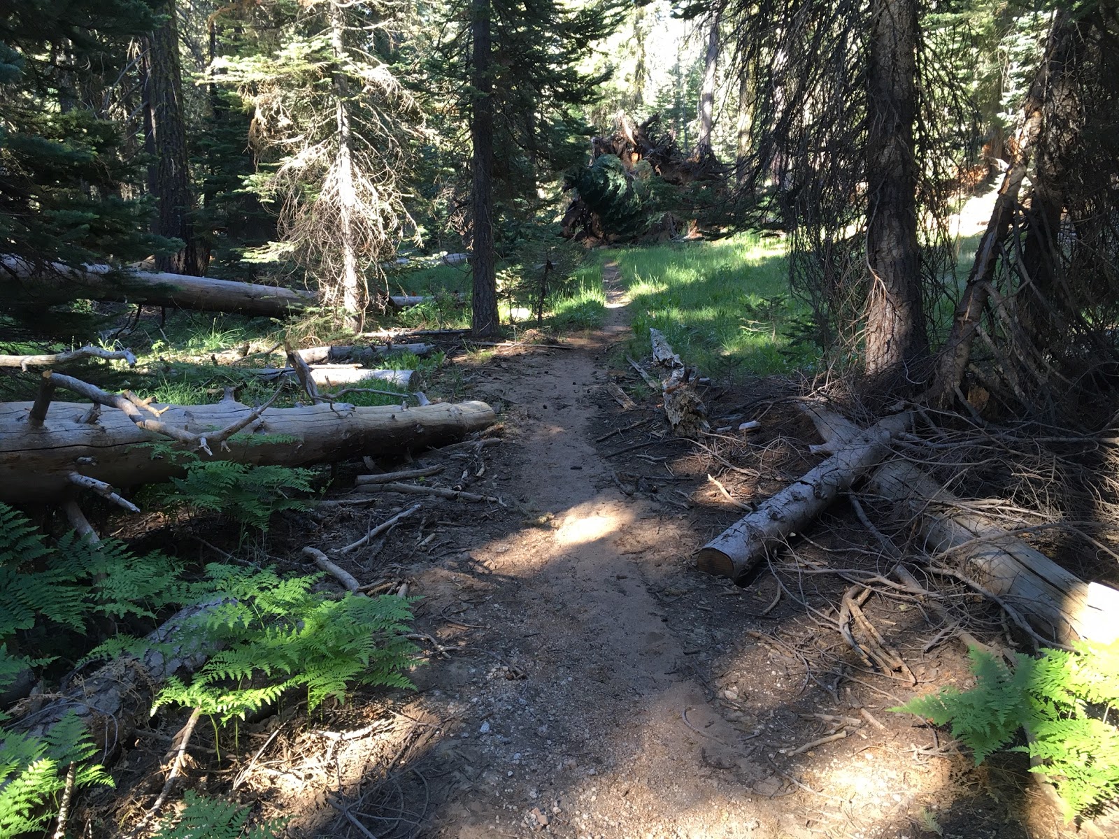
Evidence of the heavy snowpack this year, lots of downed trees

And heavily eroded roads and trails from the thaw and subsequent runoff

This trail leads into Desolation Wilderness. I planned on being on-trail to the boundary, then going off-trail to find a connector leading south towards the Two Peaks area.

The first water crossing I couldn't find a way around, guess its time to get wet, about knee deep. Luckily its pretty warm out, so I should be able to dry my shoes out later.

Found a few downed trees north of my crossing, would be a good workaround for hikers that want to stay dry.

The single track from here was great, especially after the rock garden, rock rollin fire roads.

I knew traction would not be an issue with all the firm, moist terrain. I just wanted to make sure that my tires would shed mud quickly so that I wouldn't get bogged.

Here's where I reached my limit......no wheels in the DW. I went to consult the detailed topo maps that I had printed from various sources for my next route........where are my maps....duooooh. In my haste to get gone I forgot to pack them. Compass, yup.....maps..nooooo.

I recalled a large flat and meadow area leading from the boundary and towards the southwest. I had hoped to ride/hike off trail and back country from here. I skirted the treeline area and stayed out of the meadows.

I then started to gain a little elevation and began to hike my bike through some heavily wooded areas.
I did this for about 45 minutes and made countless course corrections to find rideable areas. Eventually I found myself heavily tree'd in and my only other option to continue in my planned course through thick manzanita. Realizing that this route was a no-go, I turned back.................
now how do I get back on trail?

I was able to identify McConnell Peak with Viewranger and using my compass, I was able to find my way back to Red Peak Trail.

I got back to Bassi Creek crossing, but before getting my feet wet again, I followed the creek south and found this great spot.

Time for lunch (grilled chicken on rosemary garlic focaccia with sundried tomato pesto) and maybe a swim

I returned back on Red Peak Trail

Got my feet wet...................yet again.

Found the connection to the Bassi Creek Trail, this makes and actual loop if you were interested in hiking it.

Because biking it from Red Peak was not really feasible.

There was a lot of trail erosion and exposed rocks, boulders and roots

Did I mention the downed trees?

Less than half this trail was rideable.

On the plus side, while walking along the trail, you have great views. Especially of Two Peaks.............where I was hoping to be for the afternoon.


This section along the Bassi Fork was amazing, and the sound of the water, well you could see the appeal of camping near here.
Finally got onto some singletrack and began to ride again

Then the first casualty......extra water bottle cage on my fork got pushed into the wheel while carving a deep rut.

Trails still good though, through the middle section. Then it becomes a hiking only trail for the last section until you reach the equestrian camp. Seeing one other camper there, with his trailer and generator running............ Not content to be so civilized, I completed the loop and rode back to the area I had lunch at. pursuing my quest for a tranquil camp setting

And............I found it.

Set camp just up from this rushing water section so that I could hear it all night long. It's my second favorite sound.................the ocean being number one.

Hammock camp set.........time to start thinking about dinner and a campfire.

Part one of my sleep system is a 18 inch by 5 foot long piece of reflectix placed in the bottom of my hammock. This will reflect my body heat back toward me while I sleep and provide a wind barrier to my derriere.

Part two, Klymit scout inflatable pad inside my REI Lumen bag. The pad supplies form and support and the air chamber warms to your body temperature with the bag holding it all in and the the base reflectix doing its job. Temps dropped to 39 and I was warm and comfy all night.

After dinner campfire and catching the last traces of sunlight reflecting off the clouds. Fire permits required and of course.............check for fire restrictions before you head out. The next morning I was up at first daylight for coffee and a quick breakfast of instant oatmeal. I needed to warm up to prepare for the frigid morning water crossings I knew were about to happen. The ride out was back along Red Peak Trail for a fast few miles and the whole adventure was over.
This was a great trip but I would recommend it for hiking or backpacking over bikepacking because of all the portage and restricted areas. I'm gonna have to come back to explore the fire roads and trails from here up to Loon Lake on my next adventure.
Comments
Post a Comment