
Feather Falls Hike
Camping at Salamander Bay
(Fall River)
Oroville, CA
Plumas National Forest
We have both been chomping a the bit to Get Gone since our Mount Whitney experience. After a few false starts earlier this year, the weather finally cooperated and blessed us with some sunny weekend days. So we opened up a map........... looked for green and started planning. If you haven't noticed, we got a little bit of snow up in the Sierras. Since neither of us wanted to don packs with snowshoes for three days, we looked for green on the map, under 4000 feet elevation and there it was, Plumas National Forest.
Lets go chasing waterfalls!

This is a well trafficked trail for day hikers and plenty of information about it on the web, but back beyond the waterfalls?

Good Friday is apparently a good hiking day also

Trailhead coordinates

Beyond the falls overlook was a trail that was marked on forest service maps.
It's supposed to follow Falls River through the canyon, lets see if we can find it.

This is the typical loop that most people hike. We went up the West side of the loop beyond the Feather Falls Waterfalls (Blue Pin) to where we camped for two nights along the Fall River. This spot was about a mile North of Feather Falls (4.9 miles total). We then came back on the East side of the loop, hiked by Frey Creek Falls (yellow pin) and made our way back to the trailhead (5.5 miles total).


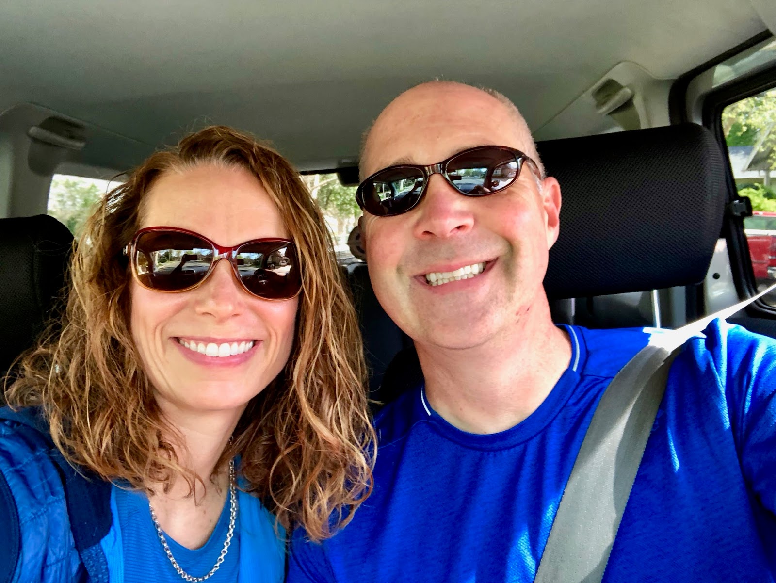
We both were pretty much grinning like this the entire hike, so happy to be back out on the trail.

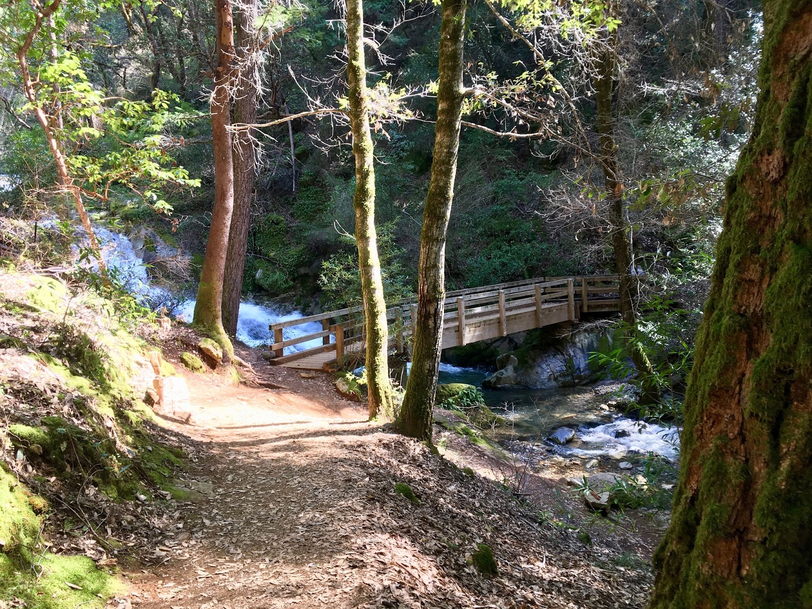
Nice meandering trail under the canopy of Oaks, Redwood and California Bay Leaf Trees.

This is where the west trail (lower loop) and east trail (upper loop) converge.


Still grinning at about three and a half miles in at a vista point.


Just past this rail and the falls should come into view, we can totally hear them now.

Our first view of the falls. We will be back to spend a little more time here tomorrow.
Wow. It's impressive.


We were planning on heading farther up the trail to try to locate the large loop trail we were in search of, but who could resist this camp?!

So, we quickly made it our home for the next couple of days.

Our location on the map with coordinates.

Fall River. It's beautiful, clear and cold! The water was rushing by and our camp was near a large area of rapids. Made for some great white noise to sleep to, but we had to talk a little louder around camp.
What did you say?


Chris is famous for asking "where is the lens again?" No retake on this one. You keep asking that and those are the pics I'm keeping! haha

So much moss growing on the rocks. The fern is finding a nice place to call home.

These are tiny little butterflies. Completely white on one side and brilliant blue on the other.

Salymander Holyfield.
There were Salamanders meandering around camp throughout our weekend stay. They are very slow on land and around the rocks, but once they get into the water, they become graceful swimmers.

The weekends mission: Find this very old trail that shows up on old maps. Chris is pondering where to begin our search for this forgotten path.


Anyone that knows us knows that "off trail" is something we do often. However, according to my Cal Topo map, it shows that we are "on-on". Hmmm, I don't think so.

Apparently there's a trail here.

Can you see it? We kept pressing on through this mess on a mission to find it! What you can't see in this picture is how much poison oak is coming up from the forest floor. It's about 8 inches tall and just barely starting to show leaves. I'm sure we've been all through it for the last hour.
Where's the Tecnu?!

Still searching for the trail... I think it might be right up here... Not!

In a drainage, there were some cool mushrooms. It was at about this time that we decided that we aren't going to find this trail, it just doesn't exist anymore. Our plan to break camp and set out to walk this large loop to Nelson's Crossing was going to have to wait. We will just have to suffer through an entire weekend by the River. Oh, the torture!

An unsuccessful mission to find the trail, but we found our way back to the river and it's awesome! So, it's not so bad after all.


Every adventure calls for a little break time.

I've got the perfect spot to relax by the river.

Chris is taking a picture of me taking a picture! haha

After our morning adventure and nap, we decided to spend the afternoon viewing the falls. Feather Falls is a Waterfall located on the Fall River, a tributary of the Middle Fork of the Feather River. There is some discrepancy about the height of the waterfall from 410ft to as much as 610ft. We weren't here to measure it's height, just to enjoy how cool it is. Although we saw the falls on our way in, we hiked about a mile back down the trail to the Observation Deck to get a better view.

There is an enormous amount of water spilling over the ledge and creating a feather effect against the rocks. While we were there we saw a rainbow created in the spray of the lower portion which also extended close to the top of the fall.


We made our way to the top of the falls and it was impressive to see the amount of water rushing over the side. Chris was much braver than I. He went out on the rocks for a closer look.


From this vantage point, the sound of the falls were deafening.

The poison oak is doing a good job of blending in with the fern and moss. If you don't know what you're looking at, you're sure to rub up against it. It's everywhere!

Back at camp and time for some fishing!
Oh, look what he caught! A flask full of hard cider. ;-)

My kitchen with a view. Making breakfast before we break camp and head home.
Hard to leave such a beautiful place.

We broke camp and began the pack out, which included a few obstacles to overcome. This tree was too low to get under with our packs and too tall to straddle, so we........well, we did this.
Giddy up!

It's a bummer we didn't get to see the ladybug show.
Must have just missed it, didn't see even one.

The upper loop or east trail was just a little bit longer than the trail in but had more gradual gains in elevation and was generally easy hiking.


There is even a warning sign about the Poison Oak. What is hard to see is that directly behind the sign is one variety that leafs out green and a little further up the hill is the variety that leafs out red. Guess this was a good place for the sign.

Frey Creek Falls

Bald Rock Dome.
This huge granite rock was formed 140 million years ago and is similar to Half Dome in Yosemite.

Of course we couldn't leave without signing and log and decorating it with a Gotta Get Gone sticker!
All in all it was a great weekend. A little disappointed that the trail along Falls River has been taken back by nature but we both agreed that a fall hike with the river levels lower would make the canyon navigable. If you're interested in day hiking this trail, its just a few hours north of Sacramento and Spring is the perfect time to go, or maybe Fall. A summer hike would be best if you had an early morning start because those oak canyons would be roasting hot from June through August.
Comments
Post a Comment