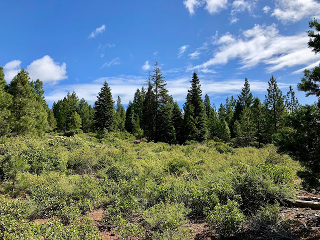
Spence Mountain Loop Trail
Klamath Falls, Oregon
Elevation at Peak 5, 841
The plan for this hike has changed several times. While I was spending a few days in Oregon, I wanted to go for a decent, longish hike. First I was going to Hike Mt McLoughlin, but weather and snow levels weren't conducive to a solo adventure. So I decided to hike a portion of the Oregon Section C of the PCT (Pacific Crest Trail). This would have been very convenient to do this after the race since the TH is only 3 miles from the lake. But since it was snowing at the race I ran by the Lake of the Woods, I scrapped that idea yesterday and was headed to do this hike today. On the way there, I drove past a Trailhead from a loop I had looked at several times. This trail gets very good reviews online and many say the views are superior to what I would see on the PCT. The PCT is very appealing because well, it's the PCT. But this TH was 25 miles closer and a 10 mile loop with great views sounds pretty good. That's the final plan! Hiking Spence Mountain Loop.
This is a new trail system that was constructed by the Klamath Trail Alliance in 2015 and had 11 miles added in 2018, it's brand new! It's a multi-use trail, great for hiking and mountain biking. It doesn't show on any of my CalTopo maps, so I was relying on the signage on the trail.
That was a good idea, the signs were great!
You can also see more info about this trail on MTB Project
The trailhead
Coordinates to the Trailhead.
I have been using CalTopo for much of my hiking and planning lately, this trail is so new that it is not on there yet. So I snapped the coordinates.
Map of the loop trail. This is a one-way trail. Counter clockwise.
South Ridge Trail to Hooligan Trail. I also took the detour to the peak and any fingers I could find that had interesting views. Added to my mileage, but they added a difference perspective with some amazing views.
Trailhead selfie..
And I'm off!
The signage on this trail is amazing. If you get lost on here, you should just stay home. haha
Every place that had a junction or crossed over a service road had another sign.
The higher I get the better the views are. The weather is cooperating for now and showing me some beautiful colors! It may turn cloudy later, so I'm grabbing as many pics as possible.
The trail meanders through trees and up and over rolling hills.
Some things just make you wonder, "How did this get here?".
An old car bumper. hmmmm?
Some rocky bits of the trail. Fine for me as I am walking, but a little more challenging in spots for the mountain bikes.
A gorgeous panorama of the rolling hills and blue skies.
A heart rock I can't take home! :-)
This one will have to stay, but loving nature's creations.
More amazing signs. I'm following the South Ridge Trail and this is where it splits to the peak to the left, then when I get back to this junction there will be another split to the overlook.
Drumroll please!! This is the peak. Kind of lackluster, but I'm standing as close as I can get. It's probably just in front of the tree that's been struck by lighting. No cache box or gotta get gone stickers here, but it's pretty nonetheless.
I'm standing on the peak! As you can see, no trails on CalTopo. But I'm the blue dot! :-)
Views from outlook
Back to the junction to head back down to the Hooligan trail. I had to stay to the side as a mountain biker went flying down this part of the trail. He was flying.
And some jumps.
This is a huge fungi! It's about 8' across.
I'm staying on the Hooligan trail back to the Trailhead.
This way...
A huge flat rock. Looked like a perfect place for a little lunch.
The trail continues to head back down the mountain. It hasn't really varied much in terrain or trees over the course of the entire loop, but it's very pretty.
And you can't beat the views. Mount Shasta off in the distance.
Leftovers from trail construction. There was 3 of these HUGE piles. Bonfire?
Another trail heart I can't take home. These are killing me. This was is kinda big anyhow. I'd need Chris to help carry this one home for me.
Oh looky!! A trail heart that's portable!
There were a number of cairns along the way. Not really necessary to show me the way, the signage is ample. But I like them just the same. If I had more time, I'd build one too.
Make no mistake. This is a one way trail. Traveled in a counter clockwise direction.
Nearing the end of the trail. I can hear the traffic from Highway 140 from here. The parking lot is close. I've hiked about 10 miles at this point.
0.1 back to the trailhead. Love these signs!
All done! Was a great day. Only thing I forgot was my visor and sunscreen.
Now I'm a little sunburned.
You'd think with as heavy as my pack is, I'd have one of everything. Thanks to SAR for that. I can't ever go out without my TEN essentials and then some. As well as 3 liters of water. Thankfully the weather stayed dry even though it was cloudy at times. I found this a nice hike. If I lived closer, it would great to also Mountain Bike. Don't think I'd hike it again as it got a little boring after 10 miles of the same. But another great day of exploring around Oregon.
A few pics of some of the flowers I saw along the way....


Comments
Post a Comment