
Lake Spaulding Sub24 Bike-packing Trip
"Ride where you can, hike where you can't and enjoy the adventure"
I had been contemplating taking out our new kayaks for an overnight, on one of the many high sierra lakes. The weather, on the other hand, was not in my favor. All week prior, the temps were upper seventies to mid eighties but come the weekend, a nice low pressure system moved in and dropped the temps down to the upper fifties with high winds. Not ideal conditions for being on the water, in a kayak, loaded with camp gear. I had been looking at the Spaulding Lake area for my adventure and took note of the many trails and fire roads......Plan B Bikepacking it is. Taking to Caltopo.com I was able to put together a loop that seemed doable....double black diamond trail....Wonder what that looks like?

Up Highway 80 take the Highway 20 exit just past Yuba Gap. Head east on 20 until you reach Bowman Lake Road, about 5 miles up you'll see the sign for Rucker Lake Road. It becomes a dirt road from there, that most high clearance cars can easily drive. Past the Liahona sign the road gets pretty rough and you'd be better off with a AWD or a 4WD vehicle. LeeLoo (My Honda Element) is high clearance but not all wheel drive, so I parked here and started my ride.


Blue Lake Road ends here about a mile up at the trail-head with plenty of parking.

More climbing and climbing and some more climbing as the fire road turns more trail-like.

The reward for all that climbing. The top of the Blue Lake Road, with a view of Blue lake

Trail sign on the tree points the way

This is the Blue Lake Trail and its the beginning of the single track trail.


Blue Lake Trail connecting with the Grouse Ridge Trail.

And apparently the start of the Black Diamond portion of trail.......that's about a 6 foot drop.

And this is the hiking portion of my bike and hike weekend. I saw one other person along this trail and he was on a full suspension Santa Cruz....he just blasted down this.

Lunch break with Old Man Mountain in the backdrop

The trail get a little more manageable as you get further down the canyon.

First significant water crossing. Time to get wet.


Back on trail just past the water crossing and came upon this pretty meadow. There was also a really nice established camp there.

This is where the Grouse Ridge Trail connects up with the Spaulding Lake Trail

Just past the trail connection, after a little down hill and I can hear water.......this flat looks interesting. Time to go off trail and explore.

An excellent call, because I found this great established campsite with cool log chair.

The view from my campsite, looking up Fordyce Creek.

Made camp......time for a hammock nap. Its late afternoon now and the temps are about 55.
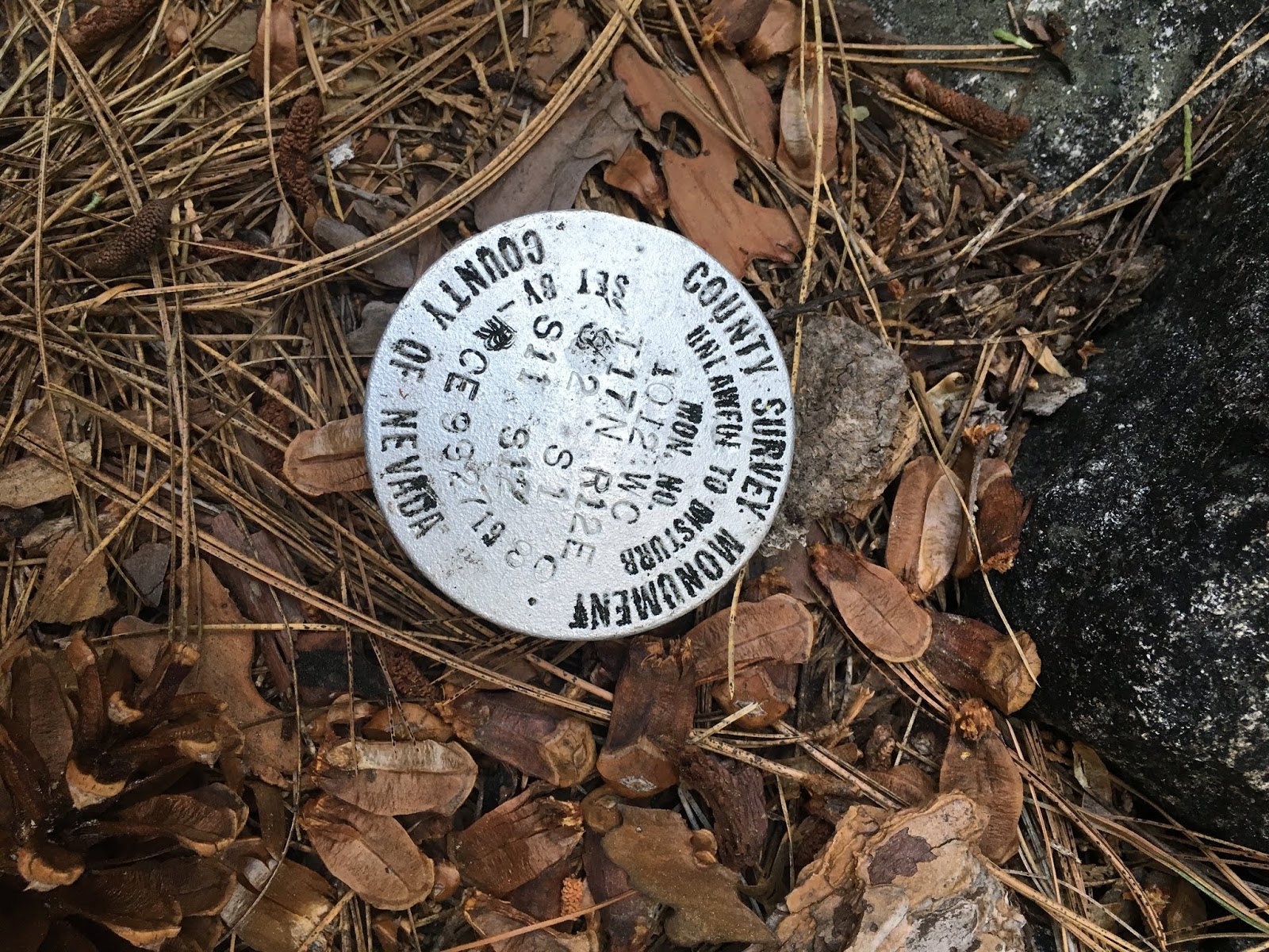
As I left camp Sunday morning I located this survey marker along the trail.


The trail runs along Fordyce Creek and through this forested area as it begins to climb.

Along the granite slabs I lost the trail a few times, but I was able to find my way back on via the cairns.

Fordyce Creek starts dropping toward Lake Spaulding and has some amazing waterfalls.


Spalding Lake trail skirts these granite fields but on more than one occasion, goes right up and over them.

Playing on the giant granite slabs, I would lose the trail sometimes. If I couldn't locate a cairn I could spot the red dot signifying I was still on the correct path.

Leaving the granite playground and heading back into the forest.

There's plenty of water crossing along this section of trail, but most are easily crossed without getting wet.


Great lake view

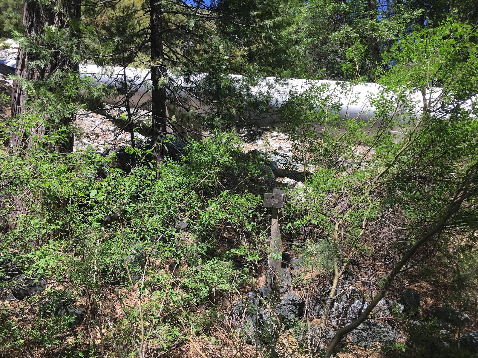
The trail splits here and I'm within a mile till I reach Bowman Lake Road trailhead. Here's where I should have consulted my map one last time. I turned left toward the lake instead of going right and under the large pipe. This would later cost me about two hours of adventuring that was not planned

I followed the trail down to the pump-house and onto a ridge along the lakes edge.

Pretty lake views the whole time and since it was mostly downhill, I just went with it.

The trail seemed to end here at the first of three dams. This is when I finally consulted my map and discovered that I went the wrong way about 1.5 miles back

Well beyond the last dam I can clearly see a PG&E power station and service roads. I just ride along the damn dams till I get there and connect up with Bowman Lake road. I just have to get up this 10 ft ladder with my bike and..................easy peasy. Well not so easy peasy, I made it to the third damn right before the power station and it was gated off with razor wire. Considering the ladder struggle I just encountered.....gate hopping was out of the question. At this point I finally admitted to myself that I had made a serious navigational error and turned back.
I made it back to the large pipe, found my trail and proceeded.............................

........................to encounter lots of obstacles, like multiple downed trees.

And giant rock slides

I finally reached trail that doesn't look abandoned
and it appears I was on the wrong side of a detour around the damaged trail section.
and it appears I was on the wrong side of a detour around the damaged trail section.

Back onto fire roads, so I must be close to the trailhead.


And here's where the trailhead meets up with Bowman Lake Road.

This was a great trip I loved the varied scenery and terrain. There were plenty of times that I was walking the bike along sections of this loop that were definitely black diamond or double black diamond. The Spauling Lake trail would make and excellent out and back day hike or a nice overnight backpack trip as well.
Comments
Post a Comment