A Quick Flight, Into The Night

Wilson Mountain, Sedona Arizona
Elevation 7,122
We had grand plans of a long weekend in Sedona, getting in some fall hikes and exploring all the trails this beautiful area has to offer.......plans changed. We flew out of Sacramento in the dark. Hiked the next day, into the dark and flew back to Sacramento early the next morning to blackened skies from the Camp Fire up near Chico.

All smiles on our way to pick up our rental car for the weekend.


Taking in the beautiful red rock formations on the drive into Sedona.
It's about a two hour drive north of Phoenix.

Courthouse Buttes as seen from the highway.

Bell Rock

After driving through Sedona on N State Rte 89A, we found the trailhead for Mount Wilson Trail. This is a popular area and the lot was already full when we arrived. There wasn't any roadside parking nearby so we considered our options and our maps. Bingo.....on Caltopo we found a spur trail connection with roadside parking and a wide shoulder.

Here's the coordinates for that spot.

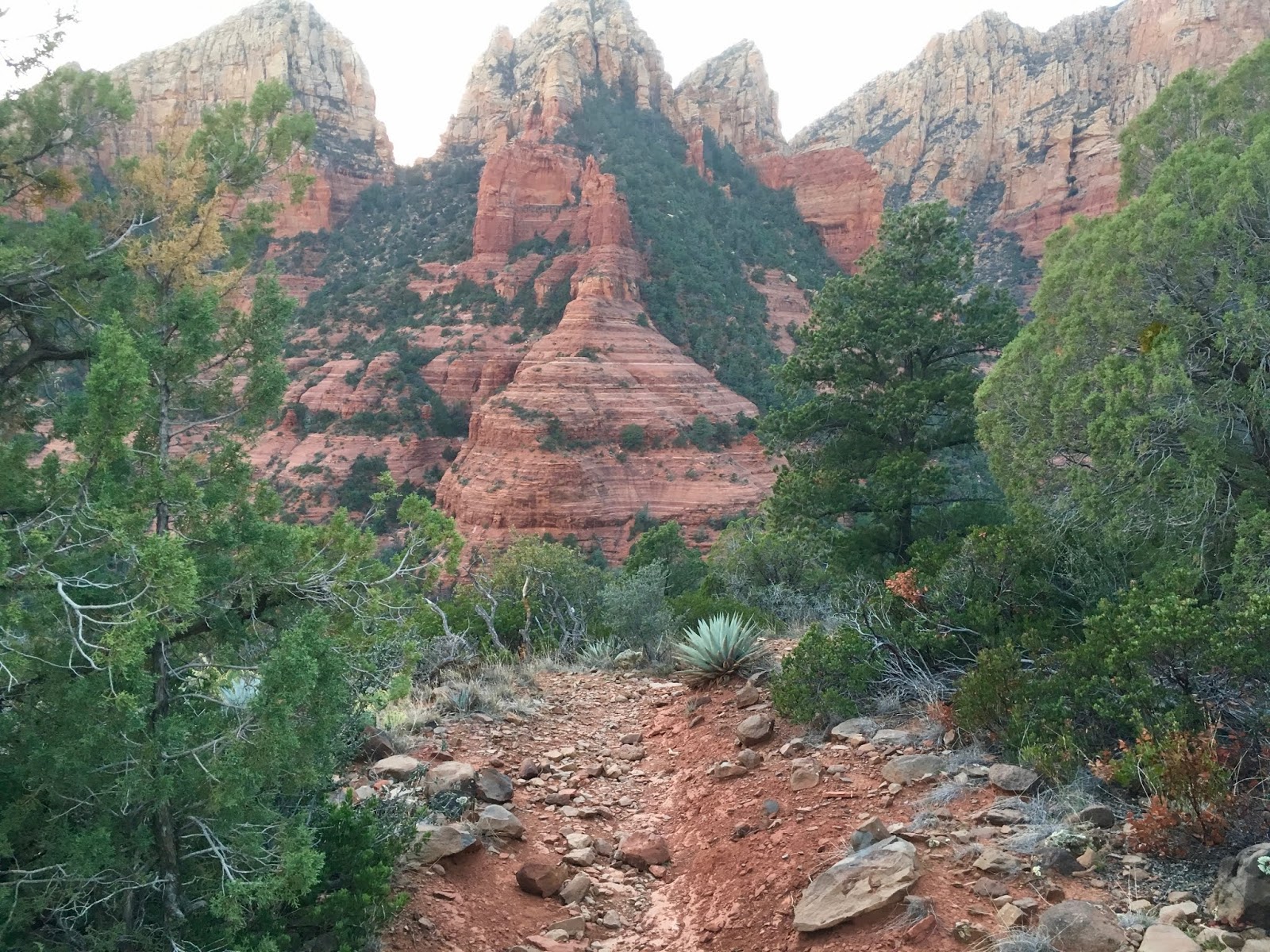
Our destination in view right from the first turn of the trail. We had initially picked this trail because of its difficulty, distance and elevation. We were hopeful that those three elements would dissuade the casual tourist hiker and we would not be on congested trails all day.

We are both experienced hikers and we quickly identified this cactus as the Stabby Narwhal from our "Chasing The Sun" trip, hiking on Mount Pinos. Very pokey indeed.

Wilson Mountain Spur D trail heading up to Wilson Mountain Spur A trail.

Looking at Baldy in the foreground......(hahahaha)

Both Spur trails connect up with the main Wilson Mountain Trail in the Coconino National Forest.

Skirting the canyons edge on our way to the peak.

2400 feet of elevation gain in five miles to the top of Wilson Mountain

Happy to be hiking, but worried about friends and family back home being affected by the Camp Fire. (Click HERE to read my story of the Camp Fire)

The approach to the First Bench of Wilson Mountain is series of switchbacks with full sun exposure.

The view of the Wilson Mountain Peak from the first bench.
Only 800 more feet in elevation gain to the top


The east side approach up the mountain takes you through and old burn scar from 2006.


About one mile in from the trail junction at the first bench,
we decided to take a more direct route to the top......ie: off trail.


The top of Wilson Mountain is a flat plateau about two miles long and .5 miles wide.
Nice treed forest on the top gave some nice sun relief.


We made our way to the south west ledge to take in views of Sedona and Oak Creek Canyon.


What views! That's a long way down.


The shadows are starting to get long and we decide, after taking a million photos, to make our way down.


Even though we had hiked up this trail a few hours earlier, everything look different in the glow of the setting sun.

The reds appeared redder and the greens, greener. Everything took on a magical glow. We tried to capture them in photos, but they just can't match the aspect and full color spectrum of the human eye.

It was also time to put on the long sleeves and pant legs.............cuz it was getting chilly


We were stopping so often to take in the views that our remaining daylight hours were waning.

With the last bit of sun casting its glow on the red rock faces of the mountains surrounding Sedona, we stowed our phones and began to hustle......oh wait

Look at how beautiful that is...........lets stop and take a picture.


Ok...............now its really starting to get dark. time to get the headlamps out.


Made it to the car in full darkness and full smiles.

Next day, 8am flight into the darkened skies of northern California from the Camp Fire near Paradice.

This route actually trims almost a mile off the hike than from the Wilson Mountain trailhead but still returns the 2400 feet in elevation gain.................faster.
Comments
Post a Comment