
Ralston Lake
At the base of Mount Ralston
Desolation Wilderness, Tahoe National Forest
Elevation 7,800 ft.
With the blistering 100+ degree heat and quarantining for months, we decided we needed a little mountain air and cooler temperatures. I only recently learned about Ralston Lake and although we have climbed Mount Ralston many times, I've never been to this like. It was time to fix that.
Ralston Lake is located just at the base of Mount Ralston and it is accessed mainly via the Lake Aloha Trail and then taking the trail towards Tamarack Lake.
Usually when craving mountain air, we are also craving some solitude. If you ever want to hike this trail from Echo to Aloha or Ralston, be prepared to share your space with lots of people. We counted 282 people that either passed us or we passed them! That's more than we have encountered in the last four years of hiking combined! Saying that this trail is heavily trafficked is an understatement. On the plus side, everyone we encountered practiced trail courtesy when passing and attempted social distancing where safe, most had masks on and available.

The Lake Aloha Trailhead is located at the top of Lower Echo Lake.


Getting there is easy, parking is another story. This parking lot was FULL when we arrived in the morning and this is how it looked when we left, still pretty full.

People also park along the street, several will come off the trail with tickets on their windshield. You can park along the road, but your wheels have to be completely off of the pavement.
We found a place to park right off of the road and snagged it. We geared up and headed out to the trailhead, which is about 1 mile away.

The trailhead is located just to the left of the Chalet.

There is also a public restroom...

But wow, that's the worst smelling restroom I've ever been in. I'm sure it's heavily used, but even with a mask on, I could barely breathe. I'd rather just pee in the woods.

There is a small boat ramp here at the Chalet. People were launching kayaks on the lake. We may want to try that one of these days. Would be a great place to paddle around for the day.

Always check the information board for any bulletins.
The water taxis are not operating for the 2020 season.

Follow the signs to the trailhead.

This trail is part of the PCT and the Tahoe Rim Trail.

And so it begins...

Ready for an adventure.

The trail follows the contour of the mountain, just above the waterline. Providing beautiful views of Echo Lake.


The trail continues and moved from soft dirt paths to walking on large granite slabs.


The trail medium does change several times. From dirt to granite slabs to lots and lots of rocks. Hiking boots and/or firm soled shoes are definitely a must.


Official trail marker.

Meandering up the hill. Rocky

Here you can see both Lower and Upper Echo Lakes.

Desolation Wilderness Boundary :-)

Although it's very rocky, it's still pretty easy to navigate.

3.7 miles from the trailhead is the marker for Tamarack Lake.
This trail will take us to Ralston, Tamarack and Cagwin Lakes.


The trail is only lightly trafficked and a little harder to follow in spots.
Our first peak at Tamarack Lake

We continued on towards Ralston Lake

A beautiful view of Ralston Peak from the opposite side.

There is a trio of ponds (unnamed)

The trail becomes much harder to follow, so look for the cairns. Can you see the cairn?

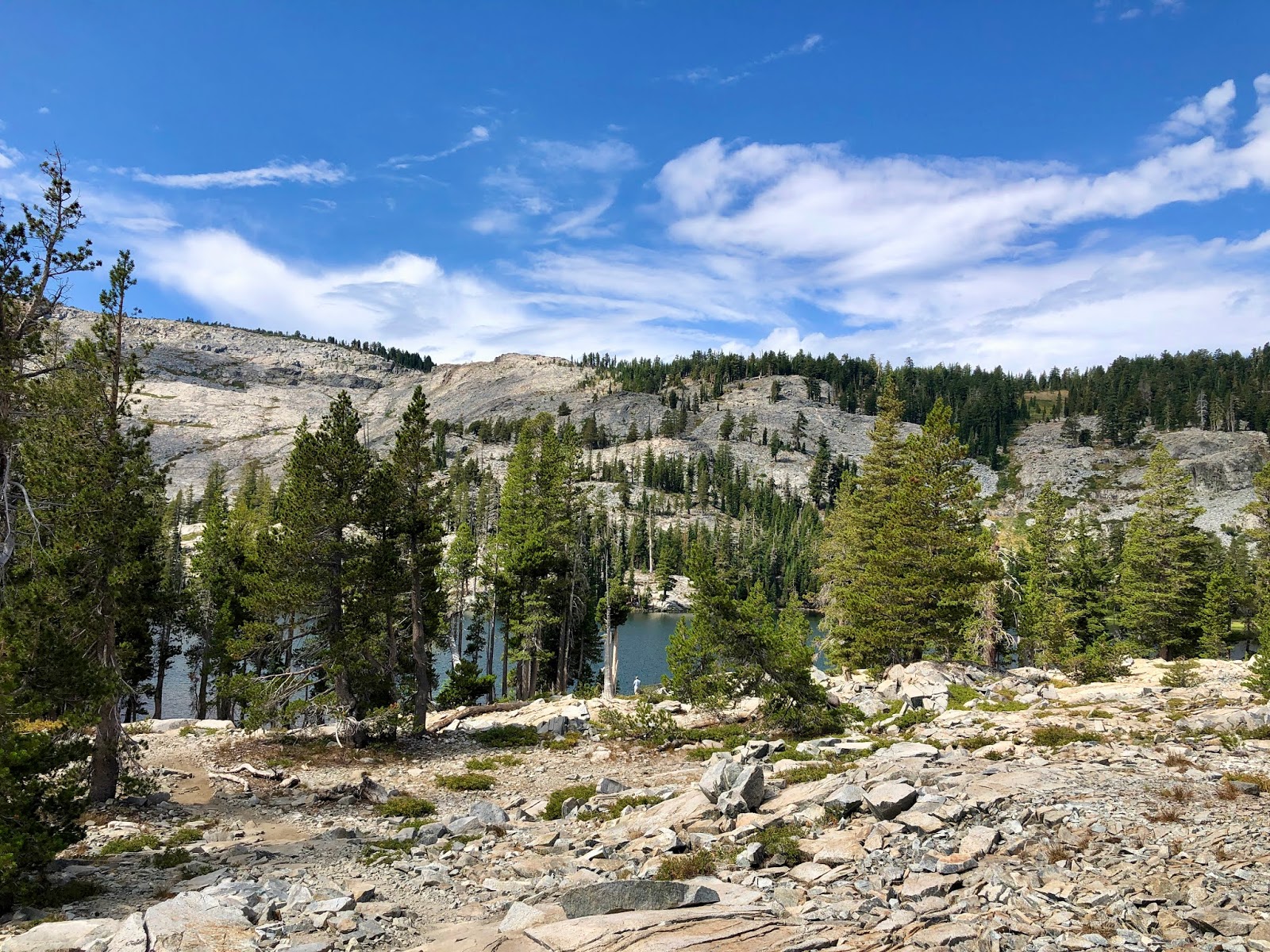
And here it is! Ralston Lake at the base of Mount Ralston.


A very pretty alpine lake.

And a great place for lunch!


We continued on the trail towards Cagwin Lake

Cagwin Lake


Some ducks were curious about it and swam on over.


Doing some investigation for an alternate route back to the main trail. It's a no go.
We continued to navigate around the area, but the trail was difficult to follow.

One more last look at Mount Ralston

We figured out that somehow we were much lower than the actual trail. So we decided to climb up.
What would an adventure be without being off trail...

Off trail is usually where you find the best views...

Trail? Nothing yet.

Still searching...

We were able to find it quickly, but that sky is starting to look angry.
And then the thunder started...

It did rain on us a little bit. Felt great and cooled things off a bit.

The storm quickly passed and now we are on our way back to the trailhead.


This somehow reminded me of Beeker from the Muppets.
And then that reminds me how old I am...
Mah Na Mah Na - remember that song?

Last good look at Echo Lake


A few more of the 282 people we encountered on the trail.


With an extra mile on each end of the hike due to parking, it was just over 11 miles round trip.
It's a beautiful hike, but we would really prefer not to be out with so many other people. Very few were on the Tamarack trail and if we were to come out to this area again, that is where we would spend more time.
Comments
Post a Comment