
Robb's PeakRobb's Mountain HutEl Dorado National ForestElevation 6,686 ft.

The hike to Robb's Peak and Mountain Hut is a 6 mile total out and back hike. From a previous trail report posted by a hiker 4 days ago, we expected to have full snow all the way from the gate to the peak, so we brought snowshoes and poles and were ready for 6 miles of snowshoeing.
Directions to the trailhead: Highway 50 east 21 miles from Placerville (8.5 miles east of Pollock Pines). Left on Ice House Road north 23 miles. Turn left on Robbs Peak road (13N31).Go 2 miles on dirt road and turn right at the fork. Travel 2/3 of a mile to the locked gate (access provided at check‐in), and continue on 1/3 mile to hut.
We did not have access through the gate, so we parked and hiked from here, which was our original plan.

When we arrived at the gate, most of the snow had clearly melted...
We strapped our snowshoes onto our packs and headed up the trail.

This is a fire road, so the trail is wide and easy to follow.

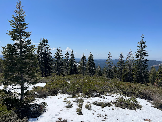
The grade was nice and easy with gorgeous views all along the way.


After about a mile, we began to see more snow.


Funny seeing these little caterpillars scooting along in the snow, but they didn't seem phased by the snow.
They are perfect for gliding right over it. They don't even leave tracks.

Can't beat the views. You can see Tallac, Ralston and Pyramid in the distance.

It could be easy to miss, but about 2 miles in, there is a sign up in the tree that points to
Robb's Mountain Hut.

We thought we might be getting ready for snowshoes, but the snow was walkable. It's only 8-10 inches deep, so even if you posthole, it's not going very far down.

The snow does get deeper and deeper from here, but we are still just fine in hiking boots.
I'm glad to have poles though.

The top is very pretty. 360 degree views of many of the mountain peaks we have stood on.

Robb's Mountain Hut is owned by the Forest Service and is available to rent. A couple were just leaving when we arrived and they said they had a great time and were just cozy in the hut.
This is almost clamping compared to how we normally travel. A warm, cozy cot, toilets and solar lights. I think we may need to make a reservation!
You can get more info about reservations HERE

This is the layout of the entire peak, lookout, mountain hut and restrooms.
Chris had taken this on a previous trip up there a couple of years ago with his drone.

We stopped for a few minutes to enjoy lunch on the picnic tables. It was a little windy and certainly colder on the peak, so we were glad we had an extra layer.

Peakfie with the birthday boy!
Taking in the views for a little longer before we head back down.


The view from the lookout.

Making our way back down. We are pretty cold after having lunch in the wind so the buff and gloves are staying on.

The views on the way down were almost more stunning than the way up.


Making our way back to the gate. It was a very nice day hike. Not too strenuous.
Snowshoeing the 6 miles may have been a bit harder, but a pretty easy hike.
It took us 1.5 hours to hike to the top and just over an hour to come back down. 6.2 miles total. Total elevation gain was just over 1,000 ft.
This would be a great family hike, especially as more and more of the snow melts.
Comments
Post a Comment