
Thunder Mountain
Elevation 9,414 feet
Thunder Mountain in the Sierra Nevada of California is located east of Silver Lake and west of Kirkwood Mountain Resort in the Eldorado National Forest. Thunder Mountain is the highest peak in Amador County
31.1 miles of hiking
5,000+ feet of elevation gain
We have some unfinished business with Thunder Mountain. Several years ago we spent some time at Shealor Lake and made an attempt at bagging this mountain. We were turned around by large snow fields and no snow shoes. Little did we know we were quite far from the peak and even with snowshoes, may not have made it. Since then, it's been on our "unfinished business" list.
We've been talking a bit about thru-hiking and what it would be like to experience a multi-day, multi-camp adventure. After our last trip to the area, Chris was very interested in hiking thru to Highway 88 and crossing over to bag Thunder Mountain Peak. He did the planning, we both got the time off of work and the wheels are set in motion for a grand adventure.
The plan...

Our 4 day, 3 night adventure takes us from Caples Creek Trailhead to Thunder Mountain Peak and back or as we called it......... the Loop to Loop hike.

We are packed and ready to go! Chris' pack weighed in at 36 pounds and mine was a whopping 42 pounds with food and 1 liter of water. I may have to re-think some luxury items when we go out next time.
Day 1

Our trip will once again begin at the trailhead to Caples Creek. We have ventured into this area several times and have had great multi-day adventures.
You can read about our last trip to Caples Creek HERE. There is so much to see and do in this area, it's endless.

The trailhead has parking, a few camping areas and restrooms. We are sure to use the facilities before the wilderness becomes our only restroom option.

And we are off!


The last trip through this area we made camp on the opposite site of the river near Forgotten Flat.


The trail makes a sharp 180° turn here and starts to head up,
this signals where we need to go off trail toward the river to make camp.

If your wondering what off trail hiking looks like...... this is it.

.............and sometimes it's over rocks, like this.


After a full mile of up and over tree stumps, boulders and through the manzanita,
we finally made it to the river.
Now to find a location to call home for the night.

Nestled right by the river.


There are times when you say "that's an awesome idea!". This was one of those things. I mentioned that I normally have a place for my boots to keep the spiders out, but didn't bring a bag this time. Chris suggested closing off the opening with the days dirty socks. Brilliant! (and after a hard days hike anything brave enough to go through those socks can have the boot ;-)

Day 1 STATS
5.04 miles with 1,028 feet of elevation gain.
We were on trail for 4 miles and seriously off trail for the last mile.
Day 2

Literally on the river, morning view out the tent.


Pushing through the manzanita to get to this meadow that we skirted around to avoid the heavy wooded route into camp.


Around one meadow and then over some rocks and we are finally back on trail.

This section was about .5 miles and 500 feet of elevation gain.

This is the connecting trail from Caples loop Old Silver Fork Trail.
It's on the map as 17E20.


Trail marker says 2 miles to highway 88. This route leads you up and over a ridge with gorgeous views to either side. Just another few hundred feet of elevation gain.


The views starting to open up on the south side of the trail.


Now along the top of the ridge the views to the north come into view,
Pyramid peak is way, way back in the distance.


Getting some forest love from the big trees up here.

At 2 miles the trail ended here at forest service road 10N16A, we noticed quite a few established campsites at this junction.


About .5 miles down the road we found a creek to top off our water bottles.

The next trail marker at highway 88.
We are taking the Horse Canyon Trail onto the Thunder Mountain loop.


But first we have to get through this nasty section of spiky stabby plants.... aka Dick Bush.

Made it through.....you can see highway 88 off to the side and beneath us now.


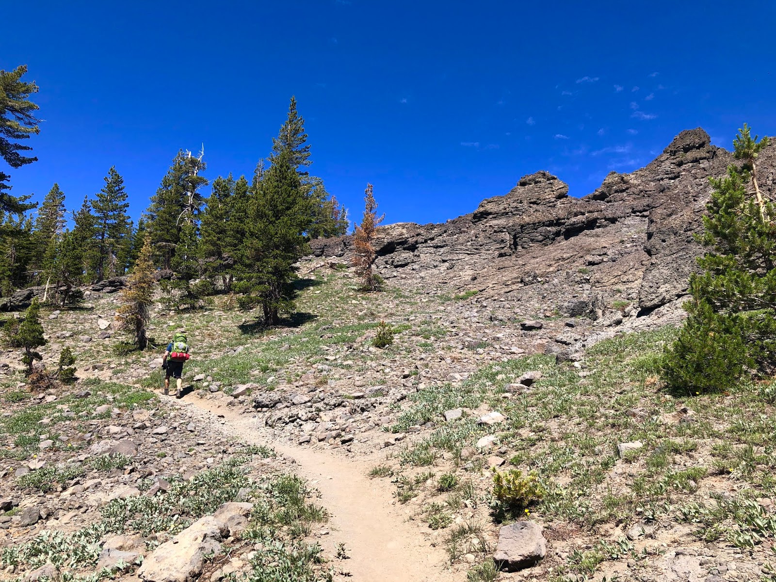
This section of trail was well used and easy to follow.

Our first glimpse of Thunder Mountain while on trail.

Examples of the volcanic rock now more evident on this trail.

By this point we were both running low on water and we had initially intended on making camp near here. The hike in was past more than one dry creek bed so we were worried we would have to detour 2 miles back down the mountain to Silver Lake to camp to have access to water.
Then suddenly we hear it............. running water. Never been so happy to hear or see water.


The topography of this area on the map and all these plants are telling us a spring is nearby.


And we found it........ a beautiful mountain spring, flowing down between Thunder Mountain and Thimble Peak. Now to find a flat place to make camp.

Looks like a good place to camp, right?

Flat located and time to make camp.
It's early evening and all we can think about is "What's for dinner".

We made camp here.
We are just outside the boundary of the Mokelumne Wilderness, so no permits needed.

With the shadows getting long and the mountain turning gold, it was time for a sunset.

and mosquito repellant.......... Charene missed a spot.

Sun setting on Thunder Mountain.

Beautiful sunset over Silver Lake.

And back to camp for the night.

Day 2 STATS
9.11 miles with 2,260 feet of elevation gain.
Day 3

Unable to get into our boots overnight, the giant spiders crept under our tents fly.

Still all smiles even though neither slept well. Something about sleeping at higher elevations seem more difficult....... that and the sound of heavy feet through the brush around our tent at 2 am.


Connecting trail to Scout Carson Lake.


From camp it was about 2.5 miles to the peak, hiking through some of the prettiest alpine trail we have been on. Our overall pace was quite slow, probably one mile per hour. Not because of the difficulty or elevation, but because we kept stopping for the views and to take photos.


Looking back down toward Silver Lake


This is where the trail spur to the peak starts.


This pinnacle on the above picture had a cave inside.

Hiker for scale.


Looking over toward Thimble Peak and Covered Wagon.


Getting Close....... peak fever setting in.


Up and over these pinnacles and toward the true summit, we decided to drop our packs.


The tippity top


Another hiker on the sub-peak, enjoying his private view

The highest point in Amador County.


Stunning views from the peak. Not the highest, but surely one of the prettiest.


Time to get off the peak and toward the tree-line to get some shade and wind relief for lunch.


Kirkwood Ski Resort does not mince words regarding backcountry skiing.


On a beeline for this pinnacle to grab some lunch.


Taking in the views, then back on trail.


This is where we made our next trail connection near the trailhead at highway 88.


Cross the highway and look for the trail marker.
This is the beginning of the Castle Point Trail and it is about 2 miles long.


Looking down the canyon towards Caples Creek.

And then we encounter this barricade.......
was this seriously a dump site for the Carson Pass area?

Looking over the barricade and all down the canyon, you could see remnants of broken bottles and glass, apparently it was the areas dumpsite.


Along the trail toward Castle Peak.
We skipped the trail spur to the top and made our way towards Martins Meadow.


Off the ridge and down to the tree line of Martin Meadow.

The road is a little rustic but there is car camping available right off highway 88 at Martin Meadow along with some vault toilets.

We made camp here away from the highway and the other campers,
also closer to water and right at the trail connection for our return hike.

Day 3 STATS
9.0 miles with 1,493 feet of elevation gain.
Day 4


This was a great campsite and after the last two spots, it felt ginormous.

My boots drying out overnight, after I fell into the creek while getting water for dinner.

Wet feet won't dampen our spirits............. just my socks.
We are ready to finish the final leg of our adventure.


The trail out of camp and some more great views along the ridge. On Caltopo.com this segment is listed as a 4WD road...........forest service maps might be a little outdated.


Making our trail connection down toward Caples Creek to finish our adventure and complete the loop.


This portion of the trail is about a mile long and shaves serious elevation....about 800 feet.

At the bottom of the decent we were looking for our next trail connection 17E71 Spring Trail,
but we couldn't locate it.


So we stayed on the main trail around the spring. This would add about another mile to our hike.


Caples Creek, filtering more water and trying not to fall in... again.

We found two great camp spots on both sides of the creek..........we just need to get across the creek.

Looking upstream seemed promising.


Up and over the rock outcropping and low and behold...........a big log crossing.


Across the creek and without getting wet, we were back on trail.

The other side of the trail connection we couldn't locate.
But the trail was quite overgrown and didn't appear to be used much.

We came across an Americorp Crew resting for lunch after doing tons of trail maintenance and forest floor clearing.


DANGER NOODLE!!
We often talk of a likely bear encounter, but we have now had TWO encounters with rattlesnakes. Both times, Chris has walked right on by and the snake must be agitated and BAM, they are coiled and rattling when it's my turn to cross their path. This juvenile was just on the side of the trail. He was coiled and rattling, but even when provoked with a trekking pole, never struck at it. Chris took his pole and relocated him farther off the trail. When mentioning this to oncoming hikers, we also heard that others had seen a rattlesnake near the river. We thought they did not live at this elevation, but after consulting Google, it appears that Western Diamondback Rattlesnakes live up to about 6,500 feet. We were just under that level. Now we know that when we get high, we don't have to worry about danger noodles or poison oak, but down low, all bets are off... and rattling.


This portion of the Caples Creek trail is just stunning.


Almost there. The last mile always seems the longest.


Day 4 STATS
8.0 miles with 205 feet of elevation gain.
A great backpacking adventure if you're up for it. You could also abbreviate the trip into smaller loops for one or two night trip. In total over 30 miles and into two counties including topping out at the highest peak in Amador County.
Now Go Out and Get Gone.
Comments
Post a Comment