
South Fork American River
El Dorado National Forest - Kyburz, CA
Elevation approx. 6,200
This trip has been in the works for a few weeks. In that time we've had food dehydrators going full force, spent time brainstorming and testing recipes and learning how to use the vacuum sealer for longer storage on the trail. So far, so good. Some even say we eat better on the trail than we do at home! Hmmmm, possibly. But, it's all part of the adventure!
Let's Go Get Gone!
Day 1
The Adventure Begins...
We both got off of work at 1, so we were packed and heading out by 2:30 or so. Since this is Labor Day weekend, we were hoping to beat most of the holiday traffic, we were pretty successful, only a couple areas of slowdown.

Silver Fork is about 8 miles off of Highway 50 near Kyburz, CA. As you pass through the tiny town of Silver Fork, the road splits to the right onto Silver Fork Rd. Follow the signs towards Silver Fork Campground and just beyond the campground and before you cross the Fitch Ranch Bridge, the road to Caples Creek Trailhead will be on your left.

The trailhead area has plenty of parking and a bathroom. This will be the last of the facilities for a while. I always take full advantage of it, although the smell of this one almost makes finding a tree more desirable.

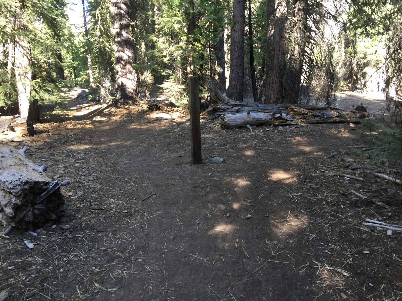
The trailhead is clearly marked. Since this is EDNF, no permit is required, except for your camp stove if you're cooking in the backcountry, which we certainly are!

We decided to hike in on the trail until we got to an area along the river to an area by Forgotten Flat. It's about 2.5 miles from the trailhead. (click to enlarge map)


We decided to set up camp on the opposite side of the river and what a great spot we found! A sandy area for the tent, a large rock to serve as a kitchen, ample trees for hammocks and a great log to sit right by the river. And who doesn't want to wake up to this view every morning?
 After we got camp set up, it was time to try out the first of several new meals. We were both responsible for a few different meals and were trying out dehydrating and new recipes. First night was Couscous with mixed vegetables and chicken. Oops, forgot to add the chicken. It was still yummy. Will tweak the recipe even more to reduce the amount of rice and add more of yummy stuff, but a good starting point.
(click here for recipe)

(click here for recipe)

Night came on quickly after dinner. Time to get ready for a cold one too. Fire restrictions are in full effect this time of year, so we lit things up with tiny LED's, solar lights and a little fire. Camp life isn't too bad right about now. Supposed to be about 40 degrees tonight and it's dropping fast. Time for a hot cup of tea and off to snuggle up in the tent.

Chris' ingenious firepot.
It's technically a "stove", but put rocks around it and light it at night and it feels like a campfire. Makes all the difference in the world.
Day 2
Exploring along the River to find waterfalls
(Otherwise known as Bushwhacking)
But first, breakfast burritos, tea and coffee... Mmmmmm...


And a little relaxing by the river is always in order.

Chris had laid out a plan to venture to an area of the river that, according to the many contour lines, could have waterfalls. There are no trails in this area, so we set out on a journey to see how far down the river we could get. Most of what we were climbing over looked like this. Lots of dead trees to climb over and under. We were able to stay pretty close to the waters edge, so it was a great reference point to keep track of where we were.
We came across our first set of waterfalls. Simply beautiful.

Who knew it would get better and better...
The falls behind us are even bigger.

We took a break and had lunch here. A yummy sandwich of cold cuts and cheese with peppers and hummus on the side. Delicious!

We pressed on a little farther and there it was, a huge waterfall. Took my breath away. Funny how something in nature is so beautiful and powerful, but because it is off the beaten path, few will ever see it. Something about that really struck a chord with me and I got a bit emotional. Being able to venture out on a gorgeous day with someone you truly care about and share these kinds of awe inspiring creations is truly wonderful.
This is also where we came across the only people we saw in the 4 days we were out there. Two men and a dog were also enjoying the waterfall. After a brief hello and a bee sting or two, okay three. The waterfall was all ours.

We spent some time at these waterfalls checking it out from all angles.

Even decided to get up to the top and sit for a bit. Wow

The trip back was a quick one now that we knew the way. More dead tree forests and rocks to climb over.

Tracks from base camp to Waterfall.

We got back to camp just in time to deploy the hammocks.
Oh yeah, a nap is about to happen!

The afternoon breeze quickly reminded us that evening was coming and cooler temps were right around the corner. It also means, it's time for dinner! Woohoo! Another fun meal to explore and enjoy at camp.

Tonight's dinner was truly scrumptious. Chris' Tom Kha Gai Soup. A coconut soup with chicken, lemon grass, ginger and cilantro served over rice. This is so good I could eat this at home on a regularly basis, and out on the trail, even more delicious!!

I'm always on the hunt for hearts and smiley faces made by nature.
The meadow right next to our camp was covered in little heart plants, but we ended up finding them all over the place.
Day 3
Peak Adventure Day

First things first though... Breakfast!!

Ok, back to the food...

French Toast is a favorite at home and even more delicious out on the trail!
I've got this recipe down so that all you need to do is add water to the mix.
Now I just need to figure out the perfect type of bread that is packable, but still makes good french toast.


And where we are headed, there is no trail, so more bushwhacking will be on the today's agenda. We crossed the river and headed up Caples Creek Trail in the direction of Highway 88.


We quickly got through a meadow and some thinned out areas of trees, then the real fun began. Because this is an area with no trails, it's covered with game trails.

LARGE game trails. With large game trails, comes large scat. A little unnerving at times wondering if we are about to come nose to nose with a bear, but their trail really was the best route up to where we were headed. And yes, I took a bunch of pictures of bear poop...

Found a huge boulder to climb under.


There were also times where it seemed easier to pass through it as others before have done. Those others happened to be large 4-legged animals, but it was fun to crawl into these areas.

We kept pushing upwards and at times were up to our ears in manzanita, literally.
I'm becoming friends with the manzanita. It's actually helpful at times. Especially when climbing down steep terrain. You can hold onto it, get your footing secure and keep from sliding around. However, it likes to reach out and grab you, slap back at you and scratch the heck out of your arms if you aren't careful.


We've hiked on trails to much higher peaks, blazed a trail up others,
but this one was nonetheless amazing.


Chris picked a great area to build a cairn. It was a bridge on top of a large rock. We collected rocks and were able to add a bit more to the elevation of this mountain. We decided since this was an unnamed peak, we would call it Bridge Mountain.

Bridge Mountain, 6,821 feet + 1.5 with the cairn!


We made quick time on the return trip. We were able to skirt around most of the thick manzanita and decided to stick to a large game trail most of the way out.

We had an overall gain of about 1,087 from start to finish.
According to Strava, roundtrip was 7 miles

Hammock time is sometimes the best part of the day!


Our kitchen rock. Not a bad place to cook a meal...

Another chilly evening, but nothing that hot chocolate and homemade style marshmallows can't fix!
Day 4
Tragedy Springs and Breaking Camp
Our last morning at camp. It's been a wonderful adventure and I'm a bit melancholy to see it come to an end. But before we can even think about heading out, we've still got breakfast, more exploring and lunch to think about!

And makin' bacon pancakes he did!
Yummy!

Now for another quick adventure! We thought we would just go straight up the hill behind us to forgotten flat and see what we can find to get ourselves into today. We seem to have an aversion towards trails, so straight up the hill we go!

We got the top for a lackluster view as there were too many trees obstructing the view. Not that this is a horrible view, but I think we've been spoiled with the peak views from yesterday. We ended up going up and over and down the other side.


But guess what?.........
Chicken butt!! haha!! Just trying to lighten the mood a bit. Breaking camp and heading home means the end to the adventure and is always a little sad, but what an amazing adventure we've had over the last few days. Couldn't have asked for a better time or a better person to spend it with.
The food is an important part of all of our adventures and now that we are armed with dehydrators, a food sealer and more ideas, the recipe page will be getting filled with lots of trail tested recipes.
This trip included:
Breakfast Burritos
Chicken Couscous with Mixed Vegetables
Tom Kha Gai Soup
Cinnamon French Toast
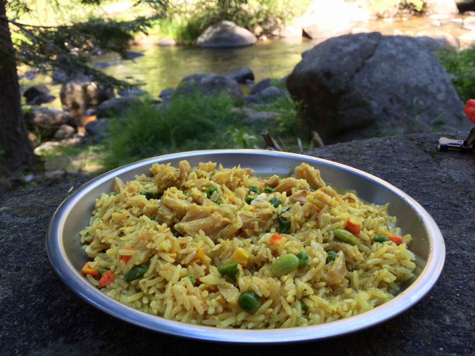
Fiesta Rice with Chicken
Bacon Pancakes
Curry Chicken with Rice
Kitchen Sink Logan Bread Bars
Apple Bars
Sweet Watermelon Jerky
With all of this cooking, we also used a TON of water.
Filtering water with my new MSR Guardian was awesome!
Read about it here
Now, Go Get Gone!!
**Most pics and maps on the page will enlarge when clicked on**
SaveSaveSave
Comments
Post a Comment